Artificial intelligence meets roadways. Road Triage turns images captured from ordinary vehicles into accurate, objective pavement and lane-line condition data — better data, lower cost.
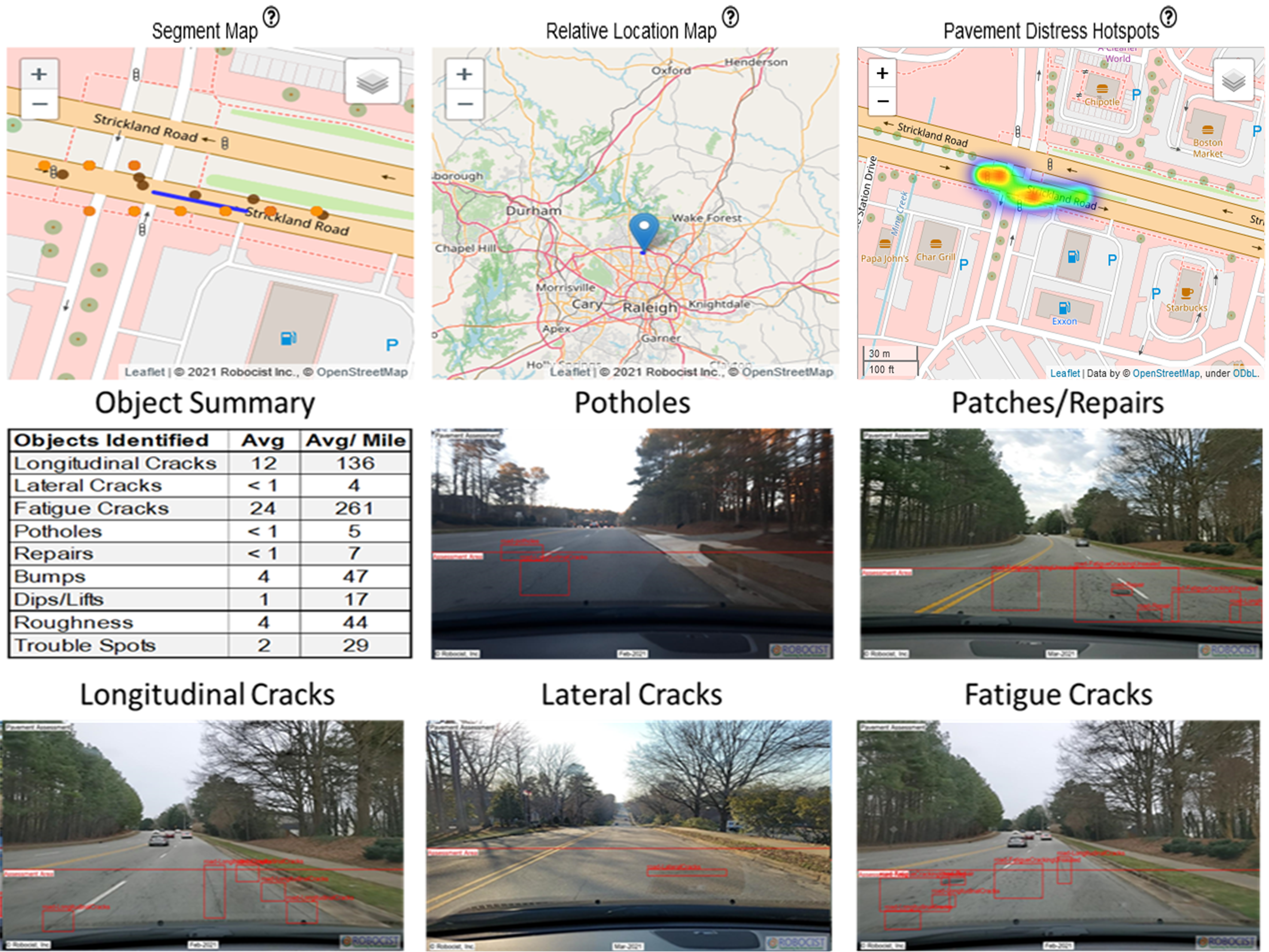
Road Triage is the ideal solution for roadway maintenance and management, providing reliable and accurate results. Utilizing advanced computer vision, machine learning, and artificial intelligence, it assesses lane lines, pavement distress, and ride quality metrics — helping transportation planners, civil engineers, and leadership make informed decisions about their roadway networks.
Track changes, catch problems early, optimize maintenance plans, and improve resource allocation with reliable data.
Scoring methodologies aligned to industry standards such as ASTM D6433 (PCI) and PASER.
Independently validated: originally developed and validated with the North Carolina Department of Transportation — and selected by Surface Systems & Instruments (1,200+ profiling systems across 26 countries) after their independent evaluation of competing AI solutions.
Images of the roadway are captured from vehicles you already have on the road — no specialized survey van.
Machine-vision models detect and quantify seventeen distress types — cracks, potholes, patches, markings — from the imagery.
Every section is scored under five methodologies aligned to industry standards such as ASTM D6433 (PCI) and PASER.
Interactive maps, statistics, change detection, and reports turn the scores into a defensible maintenance plan.
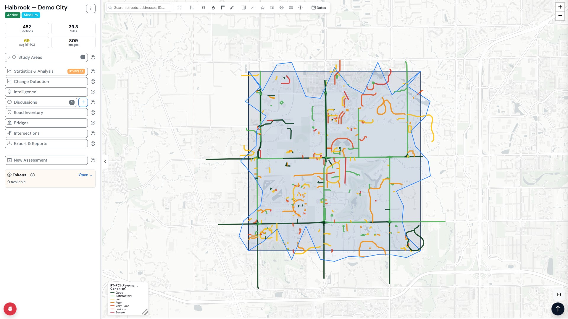
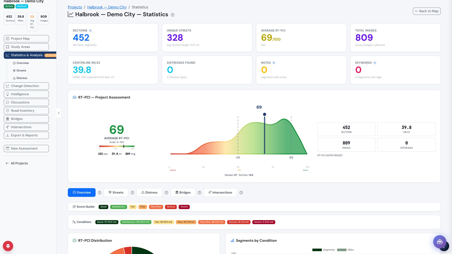
See real platform data from our seeded demo city — switch scoring methodologies, brush the distribution to isolate score ranges, search a street, or jump straight to the worst 10%. Ask us for a live walkthrough.
Road Triage has grown into a complete roadway-intelligence workspace that carries each project from field capture to funded maintenance plan.
Every section color-coded by condition, with search, study areas, and full score-range legends.
Condition distributions, street and distress breakdowns, and change detection between assessments.
Intelligence briefs that summarize what changed and what matters, grounded in your project's data.
Road inventory with bridges and intersections alongside pavement, in one place.
Conversations tied to specific road sections, so decisions stay connected to the data behind them.
Exports and reports for your workflow, plus a mobile field app for capture crews.
No specialized survey van required. Road Triage captures roadway images from vehicles you already have on the road — then our AI does the measuring.
Want the full product story, pricing tiers, and demonstrations? The Road Triage site has it all — or reach out and we'll walk your team through it.